| << | 11 |
|
|
Bicycle Tour Adventure #13 |
|
Pictures and Stories About Bicycle Tour Adventures
Great Divide Mountain Bike Route (GDMBR - Segment):
Kremmling, Radium, Gore Pass, Colorado River, Colorado, USA;
Round Trip by Bicycle Tour, July, 2005
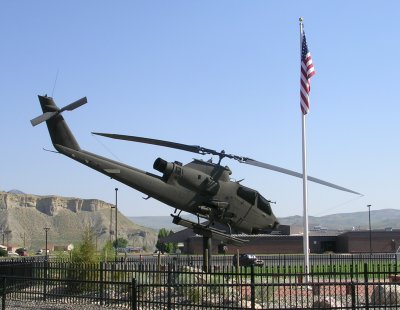
The Bike Trip Plan was to leave our camper in a safe & secure place while we (Terry and Dennis) biked from Kremmling to Gore Pass via Radium. We allotted three days for the trip but thought under ideal conditions it could be done in two days.Above Right: Any town that displays a Cobra Attack Helicopter has got to be cool! Its kind of funny, seeing what Dennis used to fly as a top of the line aircraft, is now a museum display piece. This is actually an "S" model Cobra, where Dennis only flew the "G" model. The "S" model was the upgrade that, then, incorporated night vision and the TOW (wire guided) missiles. Later the Army incorporated smart missiles with a target display and a joy stick to guide them to the target. Cool huh?
Ideal conditions did not include a bright cloudless day at hotter than normal temperatures while traversing up a fourteen mile long, baking, south facing, slope at a dreadful perpendicular angle to the radiating sun with no road shade and mostly dry creek beds.
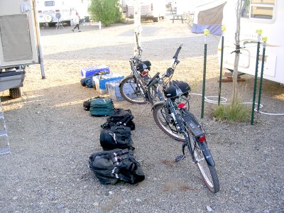
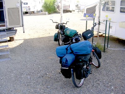
Above Right: All gear packed and mounted. You can tell by the long shadows that it is still early in the morning. Each rear bag weighs between 30 and 35 pounds, each front bag weighs 10 to 15 pounds We want to take advantage of the cool morning temperatures.
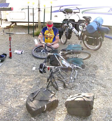
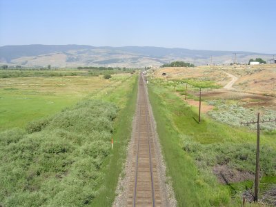
Tire Theory: Once, a while back, Dennis bought inner tubes with Slime in them. Slime is a self sealing tire leak product. It seemed like a good idea at the time. Dennis remembers having difficulty checking the tire air pressure on this particular tire, just before leaving home. Dennis got two different tire pressure readings. He theorizes that the Slime is sealing the air valve over time, thus giving a false air pressure reading (as there may be more air than indicated). Thus high pressure blowouts occur. We have heavy duty tires that take up to 90 PSI, and we normally travel with 70-75 PSI. Of our last four flat tires, three of them were Slime inner tube blowouts (Not punctures). We have quit buying Slime inner tubes and recommend the same for bike touring.Above Right: We navigated through town and crossed the railroad. This is a view to the west. The railroad and the Colorado River run parallel for many miles going through the Gore Mountain Valley side by side in some of the most daunting shear mountain walls known to man.
History: David Moffat, Jr, who earned his money in the 1860's Denver gold mining boom, built the railroad that runs from Denver, through Winter Park's "Moffat Tunnel," through Hot Sulfur Springs (with obvious mineral springs that were popular to travelers at the turn of the century) through Kremmling (along the path of least resistance next to the Colorado River), through the Gore Valley, toward Craig, Colorado. Kremmling, is one of those western towns that would have had a dubious future had the railroad not brought economic commerce to the area. The town of Kremmling is named after Rudolph Kremmling who established, apparently, the first store in the area - sometimes, location is everything. Kremmling is at the confluence of Muddy Creek, Blue River, and the Colorado River.
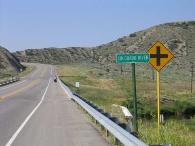
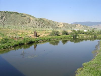
Above Right: The Colorado River. The far view mountain is the "Gore Range." Where the Gore Range drops down, in this picture, is Gore Valley and the Colorado River passage. We will be there in about three hours.
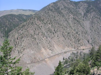
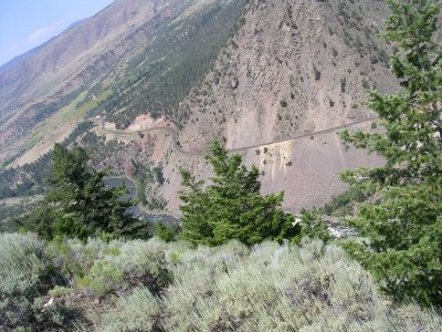
The term "Kill Gore" evolved from Sir Saint George Gore, an Irish Baronet, who arrived in these parts in 1854 to hunt. In about three years time, Gore and his hunting party killed about 2000 buffalo, 1600 elk and deer, and 100 bear. This goring occurrence was very upsetting and disturbing to both the Native Americans as well as to the New Americans. The three year hunt was guided by the famous Mountain Man, Jim Bridger.Above Right: The view is of the Lower Gore Valley, the Colorado River, and Moffat Road (David Moffat's Railroad). From here down is sage brush and piñon pine country - There is little shade and its starting to get quite warm and it will turn into the hottest day of the year for this area. Unknown to us, the mountain in the near upper-left corner will be our viewing point at about noon tomorrow.
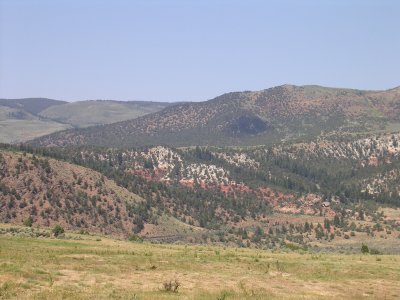
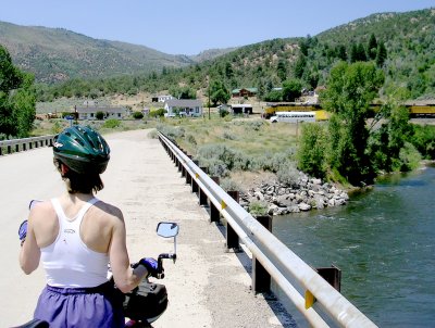
Above Right: We are at the lowest elevation that we are going to see for the entire three day trip as most of the future travel will be up hill from here. Terry is looking north across the Colorado River at the town of Radium. The town consists of about six or seven homes and a couple storage buildings. The location has three parallel rail tracks at about a mile long, in between two mountain single tracks. One track is used for railroad maintenance vehicle off line storage. Another track is the opposite direction queuing track. And the other track is the main line thoroughfare. Its a very busy place in terms of a train always being in the queue. It seemed that every time the queue cleared, it was just a matter of minutes before another train pulled in to wait or another train came in to follow the first train out.
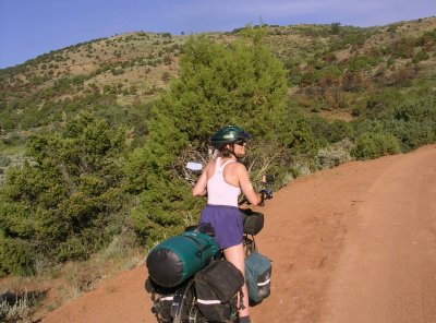
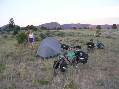
At about 2pm, after passing two dry creek beds, we were in need of water. We had only traveled about two or three miles up hill in two hours. We came across the first water in a stream bed called Sheep Creek. We stopped to use the water filter to pump water from the inch deep creek when the only vehicle that we had seen since we started climbing came to a stop. The driver stopped to see if we were OK and offered us some ice cold water. Obviously, our angels were at work again. The driver was checking us out - later we would learn that the Sheriff was looking for an attempted murder suspect. Anyway, the driver said he was the Water Commissioner and he more or less described what we would be facing for the next few miles. He let us know that there would only be one more creek with water before the D.O.W. house (the only human residence for the next ten or so miles - We figured that DOW meant Division of Wildlife).
At 3pm, we had only traveled two more up hill miles and we were heat exhausted. The drinking water was hot, the earth road was hot, and we were hot. Terry stated that we needed to rest, get out of the sun, and cool down. She was right. We parked our bikes, grabbed a water bottle each, found a tall piñon pine tree, and laid down in the tree's shadow. Terry quickly went to sleep for a half hour, Dennis slept for an hour. In the mean time, the temperature went down about 10 degrees, it was now only in the mid 80s. When we started biking again, there were shadows across the road that we could use for intermittent rest breaks.Above Right: We had just passed the DOW house at about mile seven of the uphill climb. They had a diverted creek that they used for irrigation. We had just passed the irrigation ditch when we saw the next hill to climb. It would take us at least three hours to climb that hill and neither one of us was physically ready. So we set up camp, more or less, at the base of the climbing slope. Our plan was to go to sleep early and get up early to avoid the heat for the next day’s treacherous three hour climb.
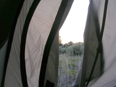
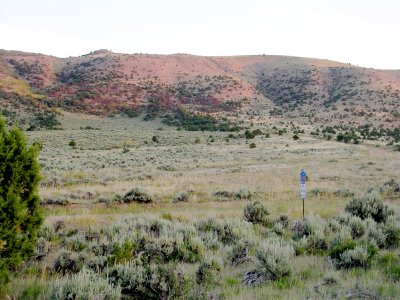
Above Right: Pictured is an early morning image of the immediate climbing challenge. If you look closely, you may see the Z shaped switchback road that we are to follow. The right-side edge of the hill top will be the cross over point. It will take us tree hours to go almost two miles (we are loving this, but burning some major calories).
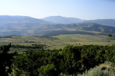
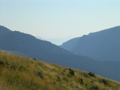
Above Right: A look eastward through Gore Valley. The middle hill on the right side holds the Inspiration Point overlook that we visited the day before. The haze comes both from taking a picture into the eastward rising sun and forest fire smoke coming from Arizona-Utah border (hundreds of miles away).
Interesting act of nature: At the top of the nearest hill, within the view of the same upper-right picture, we saw the slow motion of a coyote nosing around some sage brush. Then suddenly a large jackrabbit bolted at an uphill diagonal run. The coyote took chase. The coyote could not always see the rabbit because the brush blocked its view, so the coyote would rise up on its hind quarters every fifteen feet or so in order to get a better view while as it was chasing the rabbit. They both disappeared over the ridge and we never got to see the outcome.
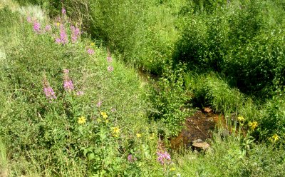
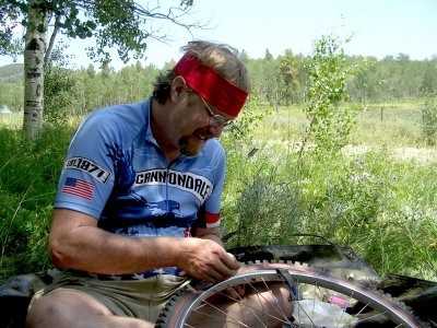
We stopped to load up water. We got just enough water to last for another four hours of heavy climb work. Our water filter became clogged and inoperable (from impurities and nasty bacteria from heavy use in the dirty irrigation ditch the night before - life happens). We were not worried, as there would be more creek water ahead and we could always boil the water and we also always carry a little chlorine bleach to kill any remaining bacteria and/or viruses. The purification boiling process is described within the Disaster Planning & Preparation Checklist.
Above Right: Over the next few hours we had managed to get up into some lower mountain alpine climate. It was still hot but we could take breaks in tree shadows. We had our second flat tire. Dennis threw a patch on it and the tire would pressure up but the tire would have to be refilled with air the next day. It was one of those leaks caused by a metal wire, from a radial tire, that was hidden in the tire rubber and the wire could not be located by feel. The good news is that the metal wire caused such a slow leak that the situation was very manageable. Brian, a technician at our bike shop (Criterium-Bicycles in Colorado Springs), figured it out after we later got home.
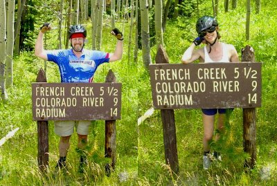
We know that we can camp anywhere, but we are now within a few miles of the actual Gore Pass, so we strategized. It is about 3 pm. We don’t know how long it will take to summit the pass and we don’t know how long it will take to ride downhill back to Kremmling. So we decide to camp as close to the pass as is possible, while staying near a water supply.
Above Right: We finally get to the end of the fourteen mile climb up from Radium. We are next to paved Highway 134 that goes from Steamboat Springs to Kremmling (via Gore Pass). We originally thought that we would camp within a few hundred feet from this spot because the map indicated that there was a creek right here. Not so, the map lied, but we are not worried because every little draw will have some usable water. So we decide to get on the highway and move along to a spot to camp that has water nearby. We are at the end of our last clean water supply and our filter is inoperable. We are thinking that we will probably have to boil water and treat it with bleach.
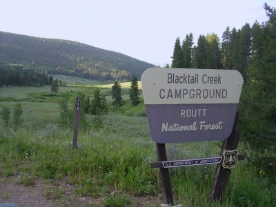
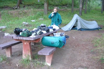
Above Right: We get the next to the last camp site just before the last camp sight is occupied. Water is plentiful and there is an outhouse toilet that actually has a seat to sit on. Life is good. Camp is set up by 4 pm and it will rain soon. [Both pictures are actually taken at departure time the next day, we were too tired to think of taking pictures on the way in!]
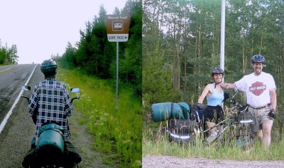
Terry: Honey, are you sure that the sign for Gore Pass with an elevation
of 9,527 Feet will actually be in the picture?
Dennis: Oh sure.
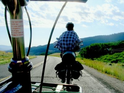
Above Right: Its a well deserved long down hill run. Here is a nice over the fender snap shot of Terry. She is wearing a flannel shirt because we are coasting and not working too hard. Its actually in the mid 60°F degree range. We got up extra early to beat the heat - we really beat the heat.
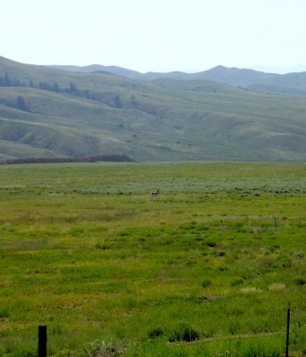
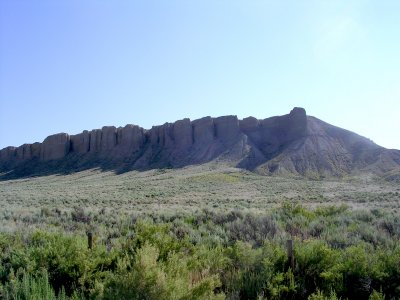
Above Right: These are table rock columns at the north side of the town of Kremmling (as also seen behind the previously exhibited Attack Helicopter picture). We covered 10 miles in 2 hours (which included a lot of picture taking). We didn't drink more than one bottle of water between the two of us.
|
|
|